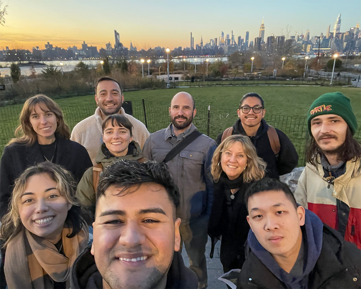
This year’s capstone class on a field trip to Bushwick Inlet.
Water defines New York City, this place of “hurried and sparkling waters,” the city “nested in bays.” These words are Walt Whitman’s, from his poem “Mannahatta”—the original Lenape word for what we now call the island of Manhattan.
Knowing the landscape of Mannahatta, that is, New York City before European contact, is crucial to understanding present-day rivers, creeks, streams, bays, ponds, and inlets: Water carves its stubborn paths to (and from) the sea on its own terms, not ours.
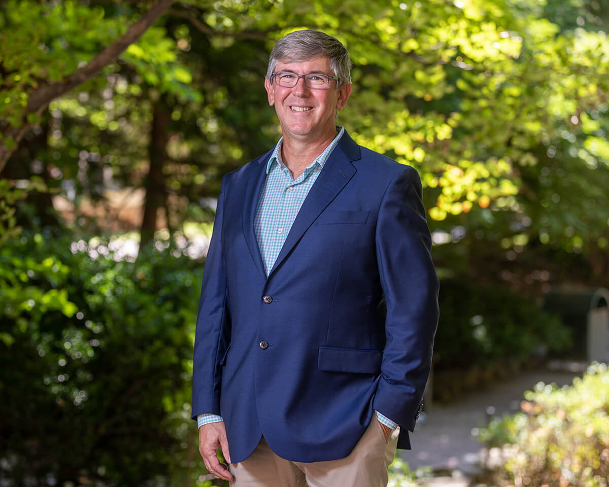
This is one of the lessons graduate students learn in a new master’s capstone course developed and co-taught by Earth and Environmental Sciences Professor Jennifer Cherrier.
Jennifer Cherrier
Instead of writing a thesis, students in the new, professional M.S. specialization in the Department of Earth and Environmental Sciences undertake a yearlong group capstone project. With Cherrier as lead instructor, they assist the New York City Department of Environmental Protection (DEP) in developing a plan for watershed-scale storm resiliency. Informed by both historical and present-day data, they focus on the implementation of nature-based solutions. This year, they applied the planning process developed by last year’s inaugural capstone cohort to a specific place: the Bushwick Inlet Basin, along the Greenpoint-Williamsburg waterfront.
Looking at that specific coastal location in the context of its larger watershed, and incorporating the use of nature-based solutions in their final site plan, these students are doing the kind of holistic work that is the future of resiliency planning in New York City—and an example of the kind of work Brooklyn College helps to spearhead locally and regionally with the Science and Resilience Institute at Jamaica Bay (SRIJB), where Cherrier is associate director for integrated water research.
How the Water Used to Flow
But let’s go back to the beginning.
McCarren Park was a salt marsh. Nearby, North 14th and 15th streets between Nassau and Wythe—where you can now buy a motorcycle or go to a climbing gym—was open water on the marsh’s edge. Where bowlers now spill out of lanes on North 12th Street, between Wythe and Berry, intertidal mudflats would have been submerged at high tide.
“We need to understand how the water used to flow,” says Cherrier.
Using historical data from renowned ecologist Eric Sanderson’s Welikia Project and his book Mannahatta: A Natural History of New York City, students learned how “water tends to follow its original pathways,” says Fiona Crisp, a master’s student in earth and environmental sciences who is in this year’s capstone class. This knowledge, she says, “allows us to work with nature to develop more creative and resilient stormwater management strategies.”
Combine that historical data with current information—the class employs state-of-the-art software like Scalgo, which “uses satellite data to show where water is going to flow,” says current master’s and capstone student Kevin Garcia—and a more complete picture about flood-prone areas begins to emerge.
Thinking Bigger
Crucially, the class has been studying urban climate resiliency at what is called the watershed scale: In the case of the Bushwick Inlet Basin project, that means looking at a—manageable—sub-watershed of the larger Newtown Creek watershed in which the basin is located.
Watershed-scale research, says Cherrier, involves tracking the water along a flow path: either starting from a rain event at the highest elevation and continuing on through the landscape all the way down to the lower-elevation coastline (as in Hurricane Ida) or vice versa—when a storm surge pushes water inland from the coast (as in Superstorm Sandy).
“Taking a watershed view of the area has changed how I think about local issues by emphasizing the fact that everything is connected,” says Crisp. “Localized flooding isn’t isolated. It is shaped by the surrounding environment and watershed as a whole.” As a result, “solutions cannot be piecemeal.”
Cherrier describes the complexity of these solutions, which must address how “to keep people safe, to keep the water clean, to enhance ecological restoration…and also to provide waterfront access—and to do this all within the lens of keeping in mind what the communities need, because the solutions are really specific” to particular places.
Thus, environmental science links with the social sciences and more, requiring the study of demographics, transportation infrastructure, parks, zoning, regulatory frameworks, etc. All this, says Garcia, is part of watershed-scale planning in the capstone class: “There are so many components that we take into account.”
Developing the Process
Last year’s class “came up with a process” for this kind of research and analysis, says Cherrier. This year’s students applied that process to the Bushwick Inlet Basin.
Co-taught by Cherrier and Simon Kates, senior project manager for planning and climate adaptation at Copenhagen-based architecture and engineering firm Ramboll (which has offices in midtown Manhattan), the course requires the group to work together as a team—which they will need to do as professionals—and it helps students develop real-world connections. The DEP is the client for the finished work.
Collaborating with the DEP is a key part of the class.
Cherrier, who was a Brooklyn College lead on the NYC Stormwater Resiliency Study, which served to inform the NYC Stormwater Resiliency Plan and whose research group has developed eco-WEIR technology to capture and treat polluted stormwater, feels strongly about ensuring that academic research—including rigorous student research—gets out into the world where it can be useful. This is one of the many ways in which the class aligns with the priorities of the SRIJB, which offers students internship and research opportunities and maintains long-running and crucial collaborations with city and state agencies, industry partners, and nonprofits—for projects like FloodNet, which has achieved an international reach.
Looking to expand these already strong connections, Cherrier came up with a “pitch” to city government: “We train your future workforce,” it began. Then: These students do research—via theses, dissertations, and capstone projects—so “what if we designed these projects in collaboration with you to ensure they align with your research needs; or in the case of the capstone, with you as a client where we could continue to build on this work so that it could be iterative year after year?”
Real-World Impact
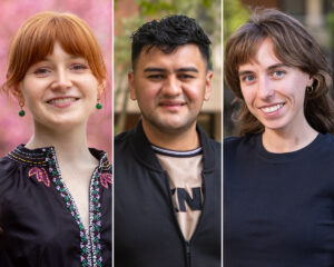
Capstone students Grace Damiano, Kevin Garcia, and Fiona Crisp
The class is structured like a professional project: Students generate a scope of work based on the needs of the client, then develop and follow a schedule to produce deliverables.
This is hugely important training for Brooklyn College students, says Cherrier, noting that “the city and Ramboll have been super impressed with our students and really love the fact that they’re so multidisciplinary.” Furthermore, the class “outputs are actually being used by the DEP,” she says, making the project a “win-win for students…and also for the DEP.”
And students are thrilled with the experience.
“Not only did we learn academic concepts, but we also applied them,” says Crisp. “Working directly with professionals made the experience more tangible and showed how our work can have a real-world impact.”
Grace Damiano, who is an earth and environmental sciences Ph.D. student at the CUNY Graduate Center and an SRIJB fellow, participated in the inaugural capstone class in 2024–25. That class began by gathering information: conducting a literature review to compile research on watershed-scale planning. Next, Damiano recalled her group producing and sending to the DEP two “massive slide decks”—one of these outlined a process for watershed-scale planning in New York City and the other applied that process to the Gowanus Canal watershed (to demonstrate how such an application might work). Damiano appreciated the variety of professionals the class had contact with, both at the DEP and beyond.
Among the professional opportunities this year was participation in a coupled two-day walking tour and workshop event on March 26–27 in honor of World Water Day, hosted by the SRIJB in collaboration with the DEP and co-facilitated with Ramboll. The event, organized by Cherrier with the support of SRIJB Executive Director Brett Branco, aimed to promote dialogue on urban watershed management with leads from several city agencies and—in a crossover with the class—focused on a watershed-scale plan for the Bushwick Inlet Basin, with the ultimate goal of getting critical input to help advance urban watershed planning and action in New York City.
Prepared by their research, the capstone class was able to fully engage in conversations with representatives of government agencies, industry partners, and nonprofits who are at the forefront of tackling these water-management issues. From a professional standpoint, that kind of contact “is very, very nice for any student who’s in a master’s program,” Damiano says, “especially someone who’s finishing up their capstone. It’s an important networking opportunity.”
It was also an opportunity to be a part of the solution.
Issues surrounding storm resiliency and flood-risk management present complex problems—ones Brooklyn College students, both now and in their future careers, will be tasked with solving. Thanks to this kind of training, in which future scientists and civic leaders learn to think big to generate local solutions, they are prepared for the challenge.